Background Information (excerpt from Gilchrist 2019)
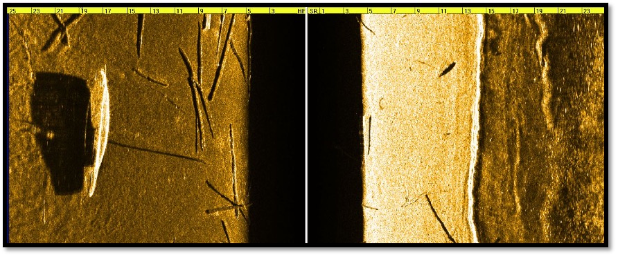
The Meredith Steam Launch is a shipwreck that lies in approximately 30 feet (9.1 meters) of water. It is located in Meredith Bay, about 80 feet from Church Landing, in a channel frequented by motorboat traffic and fishermen. The bottom at the shipwreck’s location consists of approximately 2 feet of fine silt, making visibility on the shipwreck poor. The shipwreck is approximately 25 feet (7.62 meters) long and is shaped in a style consistent with private steamboats of the early 20th century. The shipwreck rests on top of large logs, which may or may not be associated with the shipwreck. It should also be noted that the keel is intact on the vessel, and a small wire reel is attached to the top of the bow. Also, an unknown number of loose artifacts are scattered inside the vessel. A side scan image of this shipwreck is shown in Figure 1.

Figure 1. Side scan sonar image of the Meredith Steam Launch. (Image courtesy of Hans Hug Jr.)
Diving Information
GPS: N 43 39.284 W 71 29.695
Depth: 30 feet (9.1 meters)
Anchoring: This is one of the only shipwrecks on the lake I would recommend anchoring close to due to the poor visibility and amount of boat traffic passing by the spot from Church Landing and Meredith town docks.
Special Considerations: This shipwreck has some of the worst visibility I have ever seen diving in Lake Winnipesaukee (less than 5 feet). The bottom consists of a layer of silt 2 feet thick that when disturbed will make visibility zero. I personally do not consider this shipwreck a worthwhile dive!