Background Information (excerpt from Gilchrist, 2019)
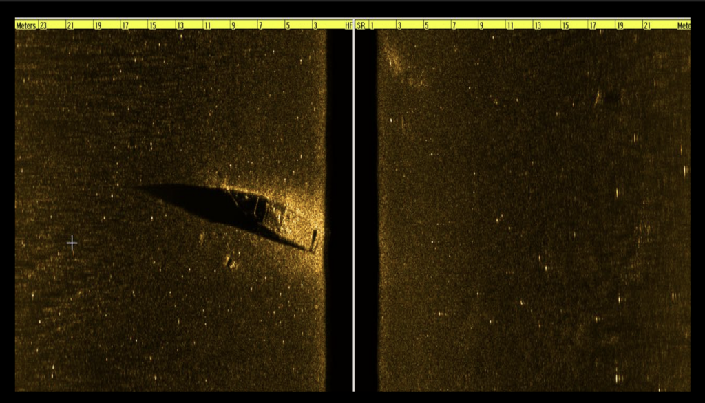
The Gilford Yacht Club Shipwreck is in the waters directly off of the entrance to the Gilford Yacht Club. It lays within approximately 26 feet (7.9 meters) of water, and the visibility is around 10 feet (3 meters). The bottom is comprised of a layer of fine silt. The wreck itself lies upright in the sand and is home to a large number of fish. It appears to be a speedboat of some kind and still has many of its metal components present. From the boat’s design, it can be assumed that it is a post-1950 vessel. It is approximately 25 feet (7.6 meters) long. A side scan sonar image of this shipwreck is shown in Figure 1.

Figure 1. Side scan sonar image of the Gilford Yacht Club Shipwreck. (Image courtesy of Hans Hug Jr.)

Figure 2. The Gilford Yacht Club Shipwreck’s engine compartment before and after its coordinates released to the public.
Diving Information
GPS: N 43 35.038 W 71 24.291
Depth: 10 Feet (3 meters)
Anchoring: Please anchor at least 25 feet from the GPS coordinates and use a marker buoy to descend to the shipwreck. Gilford Yacht Club is right there, so please be considerate about where you anchor your boat.
Special Considerations: This is a high-traffic area, so be careful and always use a dive flag. This shipwreck has sustained damage so please be careful when anchoring.